Thinking about making Fremont your home but unsure what daily life actually feels like? You are not alone. From commute routes to weekend hikes and everyday errands, the rhythm here is shaped by transit lines, parks, and close-knit districts. In this guide, you will learn how to get around, where locals gather, and how different neighborhoods support your day-to-day routine. Let’s dive in.
Commutes and transit options
Fremont sits at a practical crossroads in the southern East Bay. Many residents work nearby, commute north to Oakland and San Francisco, or head south toward Silicon Valley. Your best route depends on where you need to be and when you travel.
Driving routes to know
- I-880 runs north-south along Fremont’s western edge and connects you to Oakland and Hayward, as well as Newark and south Bay destinations.
- I-680 and I-580 are reachable via local connectors and can be useful for Tri-Valley and central East Bay commutes.
- State Route 84 over the Dumbarton Bridge is the key east-west link to the Peninsula, including Menlo Park and Redwood City.
Peak-hour congestion is common on I-880, SR-84, and major arterials like Auto Mall Parkway and Mission Boulevard. If your schedule is flexible, shifting departure times can make a noticeable difference.
BART and regional transit
- BART: The Fremont and Warm Springs stations provide direct service north to Oakland and San Francisco, with transfers to reach broader Bay Area destinations. Always check current schedules on the BART site.
- Local buses: AC Transit serves Fremont and nearby communities, with transfers to reach Santa Clara County. Review routes and timetables on AC Transit.
- Peninsula shuttle: The Dumbarton Express crosses the Dumbarton Bridge and is useful for commutes to the Peninsula. Service patterns can change, so confirm stops and times before you go.
For South Bay commutes, many residents choose to drive or combine driving with transit. If you plan to commute daily to central Silicon Valley, test your door-to-door route during typical peak hours.
Neighborhood rhythms
Fremont is often described through five historic districts, each with its own everyday rhythm: Centerville, Irvington, Niles, Mission San Jose, and Warm Springs. A transit-oriented downtown near the Fremont BART station offers the most walkable lifestyle.
Mission San Jose
You will find a hillier setting, established parks, and many single-family homes. Schools in the Mission area are widely noted for academic performance. For current boundaries and program details, review the Fremont Unified School District.
Irvington
Irvington has tree-lined streets and local shops and restaurants. Daily life here often centers on neighborhood schools, parks, and convenient errands.
Niles District
Niles offers a historic village feel with independent shops and small arts venues. Weekends often include a stroll down the main corridors and community events.
Centerville
Centerville mixes residential streets with neighborhood commercial corridors and civic services. It is a practical hub for day-to-day stops and community resources.
Warm Springs and downtown
Warm Springs features newer residential development near the BART station, plus light industrial and tech-adjacent offices. Downtown near Fremont BART delivers higher walkability, with apartments, restaurants, and retail in a transit-friendly setting.
Parks and outdoor life
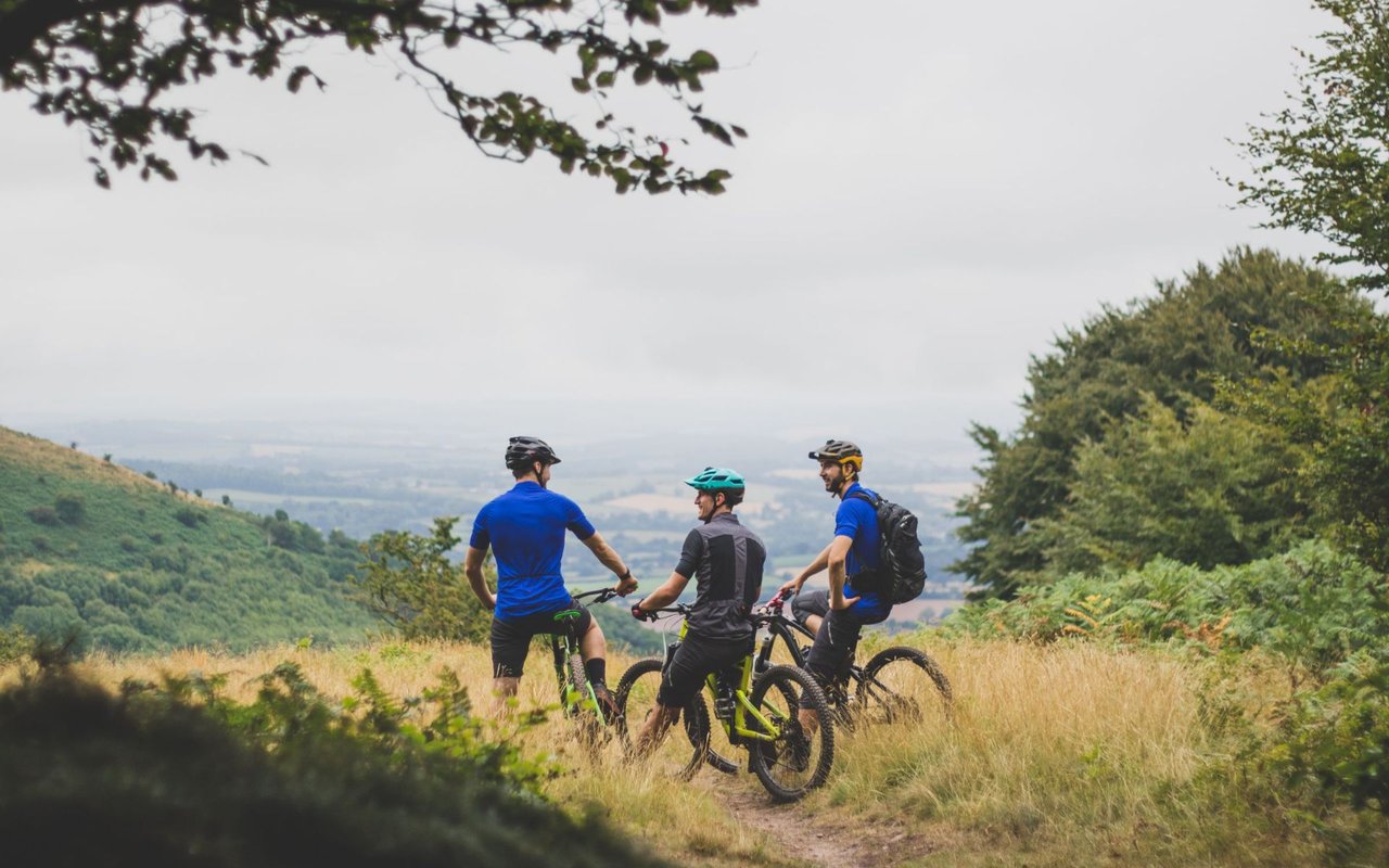
Outdoor time is a big part of Fremont’s routine. Many residents walk the lake after work, bike local trails, or plan early hikes to beat weekend crowds.
Everyday parks and paths
- Central Park and Lake Elizabeth anchor daily outdoor life with paved loops, picnic spots, and playgrounds. Check the City of Fremont site for park details and seasonal updates.
- The Alameda Creek Trail and other paved corridors make it easy to walk, jog, or bike without getting in the car.
Hikes with views
- Mission Peak Regional Preserve is the iconic local workout, popular before work and on weekends. Review trail info and advisories on Mission Peak Regional Preserve.
- Coyote Hills Regional Park offers marshland and hill trails with broad Bay views. Plan your visit through Coyote Hills Regional Park.
Water, wildlife, and family outings
- Quarry Lakes Regional Recreation Area is a summer favorite for lakeside paths, fishing, and picnics. Explore amenities on Quarry Lakes Regional Recreation Area.
- Ardenwood Historic Farm is a family-friendly living history site with seasonal programs. Check events and farm details on Ardenwood Historic Farm.
Shopping, health, and community
Daily errands are straightforward, with a mix of neighborhood shops and larger retail centers. Many residents visit Fremont Boulevard and Mission Boulevard corridors for dining and services. Pacific Commons and nearby Newark retail areas cover big-box shopping and entertainment.
Washington Hospital in central Fremont is a major regional healthcare resource. For services, clinics, and programs, visit the Washington Hospital Healthcare System.
Weekly farmers markets, seasonal festivals, and library and community center programs create a steady cadence of local events. For current calendars and facility updates, use the City of Fremont site.
Practical tips for buyers
Commute tradeoffs
If your job is in San Francisco or Oakland, BART can simplify your commute. If you travel to the Peninsula or central South Bay, driving via I-880 or SR-84 is common, though peak congestion can extend trip times. Test multiple routes and leave times before you commit to a neighborhood.
Housing types and lifestyle
Single-family homes are more common in Mission San Jose, Irvington, and much of Centerville. Townhomes, condos, and newer apartments are more prevalent near Warm Springs and downtown. If you plan to use BART or walk for errands, focus your search near transit and central amenities. If you prefer a yard and more space, you may rely more on the car for school and shopping runs.
Schools and resources
Families often review district information and school programs as part of their search. You can find boundaries, enrollment, and program updates through the Fremont Unified School District.
Safety and research
Safety and livability can vary by block. Review city resources and neighborhood updates through the City of Fremont, and combine that with your own visits at different times of day.
Ready to explore Fremont?
Everyday life in Fremont is a blend of practical commutes, accessible parks, and friendly neighborhood centers. If you want tailored guidance on commute tradeoffs, housing types, and neighborhood fit, connect with a local expert who lives this rhythm every day. Let’s talk about your plans and map a smart path forward with Moni Shah.
FAQs
How is the commute to San Francisco from Fremont?
- Many residents use BART from Fremont or Warm Springs to reach Oakland and San Francisco. Driving via I-880 is possible but often congested during peak hours.
What are Fremont’s options for commuting to Silicon Valley?
- Most commuters drive I-880 or use SR-84 across the Dumbarton Bridge. Some pair driving with the Dumbarton Express depending on their Peninsula destination.
Which Fremont areas are most walkable to transit and shops?
- Downtown near the Fremont BART station and parts of Warm Springs offer the most transit-oriented living, with apartments, restaurants, and retail close by.
Where can I find official information on Fremont schools?
- Review boundaries, programs, and updates on the Fremont Unified School District website.
What outdoor spots are close for daily exercise in Fremont?
- Locals love Central Park and Lake Elizabeth for daily walks, plus Mission Peak Regional Preserve, Coyote Hills Regional Park, and Ardenwood Historic Farm for varied trails and family outings.